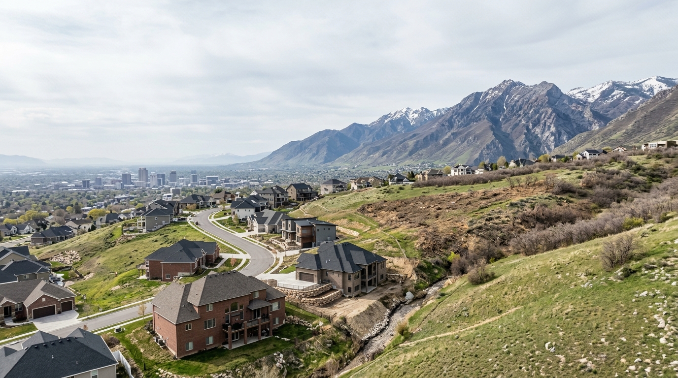
Buying a home in Salt Lake City means planning around four risks that shape both insurance and long-term ownership cost: earthquakes, floods, wildfire in the foothills, and indoor air quality from radon and Great Salt Lake dust. The one that surprises most buyers is that standard Utah homeowners policies exclude both earthquake and flood damage, the two hazards this region is most exposed to. Utah also has no state-run insurer of last resort, so a denied home has fewer fallback options than in states with a FAIR Plan. Premiums have climbed fast, and the reasons trace back to hazard exposure rather than everyday weather claims. Where you buy matters, too. East-bench neighborhoods like Federal Heights, Yalecrest, and the upper Avenues sit closer to the fault trace and the wildland edge, while valley-floor parcels carry different soil-related concerns. Understanding these factors before you write an offer keeps the surprises out of your closing.
Which Salt Lake City Risks Actually Shape Your Insurance and Ownership Costs?
The structural reason Utah insurance behaves the way it does is a low weather-catastrophe profile paired with a high underlying hazard profile. That gap explains why a state with mild storms still faces meaningful and rising premiums.
For a buyer, this means the important risk questions in Salt Lake City are not about hail or hurricanes. They are about seismic exposure, floodplain status, wildfire proximity in the foothills, and air-quality factors like radon that affect health and resale rather than your monthly premium. Each of these lands differently depending on whether a home sits on the east bench near the mountains or on the valley floor near the Jordan River.
How Serious Is Earthquake Risk Along the Wasatch Front, and Does Insurance Cover It?
The Wasatch Fault is the defining seismic feature of the region, and it runs directly through Salt Lake County's most populated corridor. The Salt Lake City fault segment averages about 1,300 years between large quakes, and the last one hit roughly 1,400 years ago, which is why geologists talk about a "big one" with an expected magnitude near 7.2.
An earthquake is not a covered peril under a standard homeowners policy. Utah policies typically exclude both earthquake and flood, and this is the single most common gap buyers overlook. Most insurers will write earthquake coverage, but few actively market it, so you usually have to ask.
Where you buy changes your shaking exposure. The eastern parts of the city closest to the fault trace, including Federal Heights, the upper Avenues, Yalecrest, Cottonwood Heights, and Holladay, would experience the most intense shaking. Valley-floor and river-adjacent parcels near the Great Salt Lake and Jordan River face a different problem: loose, unconsolidated sediments that can amplify shaking and cause liquefaction.
Construction type matters as much as location. Many older homes here are unreinforced masonry, meaning brick walls without steel reinforcement, which can collapse both inward and outward during a quake. That describes a large share of the historic brick housing stock in the Avenues, Yalecrest, and Sugar House. FEMA's "Fix the Bricks" program in Salt Lake City exists precisely to help retrofit these buildings. If you are drawn to a classic brick bungalow in one of the east-bench neighborhoods like Federal Heights, budget for a structural evaluation and ask whether any seismic retrofitting has been done.
What About Flood and Wildfire Risk on the East Bench?
Flood and wildfire are the two hazards that vary most street to street, and both are especially relevant to the foothill neighborhoods.
If it does, the lender can require flood insurance. NFIP policies carry a 30-day waiting period, so you cannot buy one the week before closing and expect it active at move-in. One caution worth knowing: Salt Lake County's FEMA Flood Insurance Rate Maps date to 2009 with revisions effective August 2012, making them more than a decade old, so a current map may understate or overstate a given parcel's real exposure. If you believe a determination is wrong, you can file an Elevation Certificate with FEMA to challenge it.
Wildfire is the faster-changing story. That interface maps directly onto the east-side foothills. This summer, Cottonwood Heights banned personal fireworks through late July, and Holladay banned them east of 1300 East, restrictions that trace the exact foothill exposure of these neighborhoods per Salt Lake City wildland fire resources. Salt Lake City has also established wildland fire evacuation zones on the east side.
A newer factor for foothill buyers is code. Under a 2025 state law, Utah cities were required to adopt the state Wildland-Urban Interface code before January 1, 2026, according to the Salt Lake City Public Lands wildfire mitigation program. For homes in or near the interface, that can bring defensible-space requirements, ignition-resistant construction standards, and restrictions on certain materials, especially for new builds. If you are looking in the foothills of a foothill community like Cottonwood Heights, ask what WUI requirements apply and whether the property already meets defensible-space guidance.
How Do Radon and Great Salt Lake Dust Affect Everyday Air Quality?
Radon is the property risk most likely to affect your family's health and least likely to show up in a casual walkthrough. Radon is a naturally occurring radioactive gas that seeps up from soil into homes; it is the kind of latent issue only a test reveals. Utah's statewide indoor average sits at 4.5 pCi/L, roughly three and a half times the national average. Because those levels vary house to house regardless of neighborhood, a radon test during your inspection period is the only reliable way to know a specific home's number. Mitigation systems are generally straightforward to install when a test comes back high.
Great Salt Lake dust is a broader, slower-moving concern. The lake ended the 2025 water year at 4,191.1 feet, the third-lowest elevation recorded since 1903, according to the Great Salt Lake Strike Team's January 2026 report, leaving roughly 800 square miles of former lakebed exposed. Dust plumes from that exposed bed can reach across the entire Wasatch Front. The reassuring part: more than a decade of Utah Division of Air Quality monitoring has shown no increase in airborne arsenic or heavy metals as levels dropped, with the highest recorded arsenic reading 100 times below California's health thresholds. Dust is a real air-quality and quality-of-life issue for every neighborhood from the Avenues to Sugar House, but the current toxic-metal alarm is not supported by the monitoring data.
Why Have Utah Homeowners Insurance Premiums Risen, and How Do Coverage Gaps Get Filled?
Utah premiums have risen faster than the national average even though the state remains cheap by regional standards. The Utah Insurance Department documented steady annual filed increases building through 2024.
The coverage gaps are the part that trips up buyers. Because standard policies exclude earthquake and flood, and because Utah has no FAIR Plan or state insurer of last resort, a buyer has to assemble protection deliberately. Two tools fill the gaps. Flood coverage comes from the NFIP. Earthquake coverage comes as an add-on from most carriers, or through a Difference in Conditions policy, a supplemental policy that bundles catastrophe perils a basic homeowners policy leaves out, including earthquake, flood, and mudslide. For a home with a finished basement, a Difference in Conditions policy is often the cleaner solution because it can combine those perils under one roof.
| Peril | Standard Utah homeowners policy | How to cover it |
|---|---|---|
| Earthquake | Excluded | Carrier add-on or Difference in Conditions policy |
| Wildfire | Typically covered | Standard policy; foothill parcels may face WUI requirements |
What Address-Level Records Should Buyers Check Before Closing?
Statewide and county figures set expectations, but every real decision comes down to the specific parcel, and several public records let you verify a given address before you commit.
Check the FEMA National Flood Hazard Layer or the Salt Lake County FIRM viewer to confirm whether the property sits in a flood zone beginning with A. Use the Utah Geological Survey Geologic Hazard Portal to pull the parcel's fault-trace proximity and liquefaction classification, which is the concrete way to translate "east bench versus valley floor" into a number for your specific lot. Confirm WUI status and any defensible-space obligations with the municipal fire authority, whether that is Salt Lake City Fire or the relevant Cottonwood Heights or Holladay department. And schedule a radon test during your inspection window rather than relying on county averages.
Utah's seller-disclosure rules make this legwork especially important, because the state operates on a modified buyer-beware standard. Under Utah Code § 57-27-201, the only environmental condition a seller must affirmatively disclose is methamphetamine contamination, and even that drops away once a certified specialist decontaminates the property to state standards. Under Utah Code § 57-1-37, a seller need not disclose that a home is "stigmatized" by a death or similar event. Sellers must disclose known latent defects and cannot lie if you ask a direct question, but the burden to investigate hazards sits largely with the buyer. Sellers also must disclose water rights included in the sale, identifying the water-right number, which matters more than newcomers expect in Utah's arid climate.
The practical takeaway: build your inspection period around these lookups. A thorough approach to the home inspection process for Utah buyers should fold in radon testing and, for older brick homes or foothill parcels, a structural and defensible-space review. Knowing which documents to review before buying a Salt Lake City home keeps the fault map, flood determination, and disclosure forms in front of you before the deadline to walk away passes.
Frequently Asked Questions
Does standard homeowners insurance in Utah cover earthquakes and floods?
No, standard homeowners policies in Utah exclude both earthquake and flood damage, so each requires a separate policy or endorsement. Earthquake coverage is available through private insurers, while flood insurance is typically issued through the National Flood Insurance Program (NFIP). Given Salt Lake City's position along the Wasatch Fault and the presence of FEMA-mapped flood zones near waterways and the Jordan River corridor, treating these as optional add-ons rather than necessities is a risk worth examining carefully.
How likely is a major earthquake along the Wasatch Front?
The fault runs directly beneath the Salt Lake Valley, which means shaking intensity and liquefaction potential vary significantly by neighborhood depending on soil type and proximity to the fault trace. This is not a remote or theoretical risk, it is a central consideration when evaluating any Salt Lake City property.
Are homes in Avenues, Yalecrest, and Sugar House more vulnerable because of older brick construction?
Unreinforced masonry, the solid brick construction common in pre-1970s homes throughout the Avenues, Yalecrest, and Sugar House, performs poorly in earthquakes and is among the most documented structural vulnerabilities in Salt Lake City's housing stock. These homes have undeniable character and strong market appeal, but a pre-purchase seismic assessment and a conversation with a structural engineer about retrofitting options are worthwhile steps before closing. Seismic retrofits can reduce risk meaningfully, though costs and scope vary by structure.
Why have Utah homeowners insurance premiums increased so much recently?
Premiums have risen across Utah largely because insurers are repricing for wildfire exposure, inflation in construction costs, and reinsurance market pressures, factors that affect the entire Mountain West region. Salt Lake City properties near the urban-wildland interface, particularly in foothill neighborhoods, have seen sharper scrutiny from underwriters, and some carriers have tightened coverage terms or non-renewed policies in higher-risk zones. Shopping multiple carriers and reviewing your coverage limits against current replacement costs, not market value, is a practical response to this environment.
How can I find out the specific flood, fault, and wildfire risk of a Salt Lake City address?
Three public tools cover the main hazard layers: FEMA's Flood Map Service Center shows whether a property falls within a Special Flood Hazard Area; the Utah Geological Survey's online hazard mapping tool displays fault traces, liquefaction susceptibility, and landslide zones by address; and the Utah Division of Forestry, Fire and State Lands publishes wildland-urban interface maps that identify properties with elevated fire risk. Running an address through all three before making an offer gives a concrete, address-specific picture rather than a general neighborhood impression. Check current versions of each tool directly, as hazard map boundaries are updated periodically.