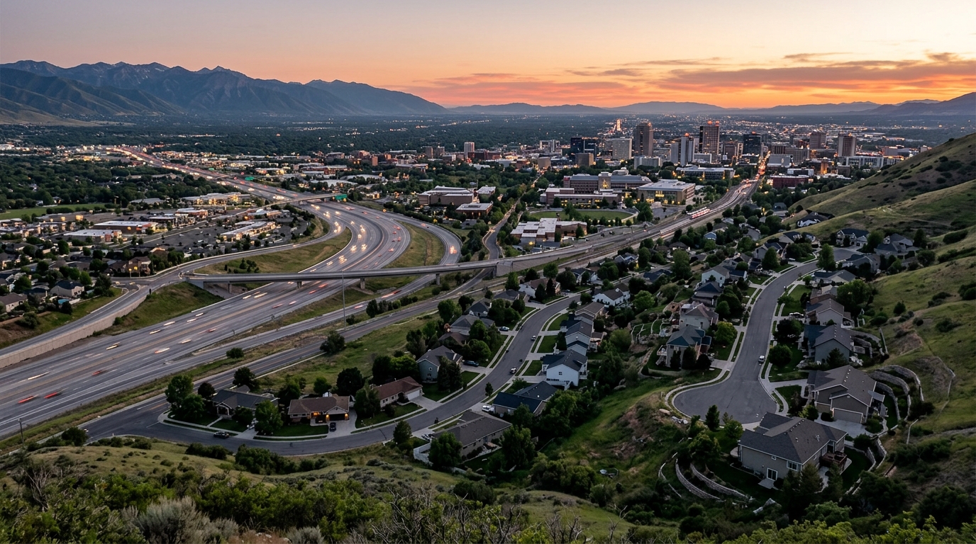
The commute tradeoff between Federal Heights and Holladay comes down to a single question: are your daily destinations concentrated near the University of Utah and downtown, or spread across the whole valley? Federal Heights, a residential neighborhood in the northeast corner of Salt Lake City below the Block "U", sits less than a 10-minute drive from downtown and immediately adjacent to the University of Utah, with the TRAX Red Line campus stations right beside it. Holladay, an incorporated city in central Salt Lake County, trades that anchor-proximity for freeway centrality: the southeastern quadrant of the I-215 beltway wraps its northern edge, feeding directly toward Salt Lake City International Airport and both I-15 and I-80. Federal Heights wins for a University or downtown routine and rail access. Holladay wins for dispersed, multi-directional driving and frequent airport trips. Neither has the other's strength, so the choice follows your actual weekly map, not a general sense of "convenience."
Which area puts you closer to the University of Utah and downtown?
Federal Heights is the clear answer for a University-of-Utah or downtown-centered life. The neighborhood covers the area east of the Avenues from about Virginia Street to the University of Utah, running north from roughly 100 South, and the Salt Lake City Council District 3 profile places it in the northeast corner of the city on the Wasatch hillside. The University of Utah campus, its hospital, and its research buildings lie just south and east of the neighborhood, which means faculty, medical staff, and graduate students can reach work without touching a freeway at all.
That downtown proximity is real, too. Federal Heights is less than a 10-minute drive from downtown Salt Lake City, so a household whose weekday orbit is the campus-to-downtown corridor rarely needs to build a commute plan around traffic. The tradeoff is that the neighborhood is oriented toward the northeast corner of the valley. Trips to the south end, think Sandy, Draper, or the Point of the Mountain tech corridor, run against the grain and take longer than they would from a more central base.
The physical layout of Federal Heights reinforces this. The streets are narrow and curved, deviating from the standard grid that makes most of Salt Lake City so easy to navigate. That gives the neighborhood its quiet, tucked-in character, but it also means there is no freeway inside it. Freeway access requires driving down to the I-80 and Foothill Drive corridors to the south. If you want the fuller picture of daily life here, the living in Federal Heights guide covers the neighborhood beyond the commute question.
What does Holladay's I-215 beltway and airport access actually buy you?
Holladay is built for valley-wide driving. The southeastern quadrant of Interstate 215 encircles Holladay northward toward I-80, and the beltway provides a bypass for both I-15 and I-80 while connecting directly with Salt Lake City International Airport. For a household with errands, schools, work, and family scattered from Taylorsville to Cottonwood Heights to the airport, that beltway access is worth more than raw proximity to any single anchor.
The airport connection is the sharpest single advantage. Federal Heights reaches the airport by working west through the I-80 corridor, but Holladay has a direct beltway path: get on I-215 and the road carries you around the valley's edge to the terminals. For frequent flyers, consultants, or anyone who lives out of a carry-on a few weeks a month, that is a meaningful daily-life difference rather than a technicality.
Inside the city, Holladay runs on a more conventional suburban grid. State Route 266, known locally as 4500 South and 4700 South, is a west-to-east thoroughfare connecting both sides of the I-215 beltway, with its east end at Wasatch Boulevard in Holladay (the Utah State Route 266 route description). That kind of arterial makes Holladay noticeably easier to move around by car than Federal Heights, where the curved bench streets slow you down.
Holladay's limitation is the mirror image of its strength. It sits farther from both downtown and the University of Utah than Federal Heights does, and it has no light rail within the city. When I-215 was originally proposed, residents opposed a route that would have cut through the primarily residential suburb, so the beltway ultimately skirts the city rather than running through its core. That is good for neighborhood quiet and good for beltway access, but it means the freeway serves the edge, not every doorstep. The living in Holladay guide and the overview of Holladay's neighborhoods go deeper on where within the city that access lands.
Does either area have light rail, or is transit bus-only?
Federal Heights has functional light rail access; Holladay does not. This is the single cleanest transit distinction between the two. The University of Utah campus, immediately adjacent to Federal Heights, features four TRAX stations: Hospital, Fort Douglas, South Campus, and Stadium. All four sit on the UTA Red Line serving the University of Utah, which runs from University Medical Center out to Daybreak Parkway. A Federal Heights resident can walk or take a short bus ride to a Red Line platform and reach downtown, the Central Business District, or the airport connection without driving.
Those campus stations also tie into the bus network. The University South Campus station connects to UTA bus routes 9, 17, 213, 455, and 473 (the University South Campus station transit connections, which extends the rail reach for anyone whose final destination is off the Red Line). (UTA - Commuter Services - The University of Utah)
Holladay's transit is bus-based. UTA Route 223 runs the 2300 East and Holladay Boulevard corridor, and a UTA day pass covers unlimited rides that day across bus, TRAX, FrontRunner-adjacent services, and the S-Line streetcar per the rideuta.com Route 223 schedule. There is no TRAX line inside Holladay, so a car-free commute from there depends entirely on bus frequency and transfers. UTA has signaled more east-side transit investment for Murray, Holladay, and Cottonwood Heights in 2026, so this picture may improve, but as of now the rail-versus-bus gap is the practical dividing line.
How does Holladay's measured commute compare with the metro average?
Holladay commuters have a shorter-than-average drive. Most people in Holladay drive alone to work, and the average commute time is 19.8 minutes according to the Census Reporter profile for Holladay drawing on ACS 2019-2023 data. That figure is about 87 percent of the Salt Lake City, Murray metro mean of 22.8 minutes, which the source rounds to roughly 90 percent. In plain terms, a typical Holladay resident spends a couple fewer minutes each way than the metro norm.
A few details sharpen that number. Only about 0.472 percent of Holladay's workforce reports "super commutes" exceeding 90 minutes, so extreme drives are rare here. And the city loses population during the workday, with a daytime change of about −12.3 percent from commuting outflow, meaning most residents leave Holladay for work rather than working inside the city. That is a normal profile for a residential suburb, and it is one reason the beltway access matters so much: those outbound trips fan out across the valley.
Federal Heights has no comparable place-level commute figure. Because it is a neighborhood within Salt Lake City rather than a Census-designated place, the Census Bureau does not publish a stand-alone commute-time estimate for it. If you want a number for Federal Heights specifically, the way to get one is a ZIP Code 84103 pull from the American Community Survey table S0801 at data.census.gov, or a tract-level query covering the neighborhood.
How should you choose based on your daily destinations?
Start by mapping your real week, not your ideal one. List where you actually go on a typical Monday through Friday: work, school drop-offs, the gym, standing appointments, the airport if you travel. The area that shortens the most of those trips is the right one, and the two areas pull in genuinely different directions.
Here is the core comparison at a glance.
| Factor | Federal Heights | Holladay |
|---|---|---|
| Governance | Salt Lake City neighborhood, ZIP 84103 | Incorporated city, ZIPs 84117 / 84121 / 84124 |
| Downtown SLC | Less than a 10-minute drive | Farther; central-valley suburb |
| University of Utah | Campus adjacent, south and east | Commuter distance |
| Freeway reach | No freeway inside; nearest is I-80 / Foothill | I-215 beltway wraps the northern edge |
| Airport access | Via the I-80 west corridor | Direct I-215 beltway path |
| Light rail | TRAX Red Line campus stations adjacent | None; bus only (Route 223) |
| Measured commute | Not published at neighborhood level | 19.8 min average (ACS 2019-2023) |
Choose Federal Heights when your decision-critical destinations are the University of Utah or downtown, and when rail transit on the Red Line genuinely matters to you. A hospital clinician, a professor, a graduate student, or a downtown professional who values not needing a freeway for the daily drive is the natural fit here.
Choose Holladay when your destinations are dispersed across the valley, when the I-215 beltway and airport bypass carry real weight in your week, and when you want the services and identity of a standalone city government. A frequent traveler, a parent shuttling between schools and activities in different suburbs, or a two-career household with jobs on opposite ends of the county tends to come out ahead in Holladay.
If you are weighing Federal Heights against nearby bench options rather than Holladay, the comparison of housing choices in Cottonwood Heights versus Federal Heights covers that adjacent decision, and anyone new to the area entirely will find the moving to Salt Lake City guide a useful starting frame.